Most of us rely on GPS daily — whether it is for navigating city streets, tracking a food delivery, or making sure our kids got to school safely. We tap “Directions” or open a tracking app and just expect it to work. But have you ever stopped to ask who invented GPS, and how a Cold War-era military project ended up in every smartphone pocket?
So, today we would like to go through the early days of GPS, the brilliant minds behind it, and the surprising journey from satellites built for missiles to tools built for everyday safety and convenience. Spoiler: it wasn’t just one person who gave us GPS — it took decades, dozens of scientists, and a little help from Albert Einstein. But first things first.
Before GPS: Getting Lost Was Part of the Journey
It’s easy to take global navigation for granted today, but things weren’t always so simple. Before GPS, people had to rely on a combination of maps, compasses, radio signals, and — let’s be honest — guessing. In both military and civilian life, finding your position on Earth wasn’t always accurate, especially in air and sea travel.
Here’s what “navigation” looked like before GPS:
| Method | Description |
| Paper maps | Still essential but often outdated or vague |
| Magnetic compass | Useful but not location-specific |
| Sextant and stars | Used by sailors for centuries |
| Inertial navigation | Complex system used in aircraft |
| Radio beacons (LORAN) | Signal triangulation system |
In aviation and naval navigation, things were even more complicated. Crews often had to calculate their position manually, using complex math and time-consuming methods. And even small errors could lead to dire consequences.
Interesting fact: As late as the 1970s, pilots and submarine crews were doing manual calculations to figure out their location — sometimes with errors of dozens of miles.

So, Who Invented GPS? Meet the Minds Behind the Satellites
Well, possibly you might guess that GPS wasn’t the brainchild of a single genius. Instead, it was the result of collaboration between scientists, engineers, and government agencies. Here are the three key figures often considered as the fathers of GPS:
| Name | Role in GPS History |
| Ivan Getting | Visionary at The Aerospace Corporation who pushed for a satellite-based system |
| Roger L. Easton | Naval Research Lab engineer who developed time-based satellite tracking concepts |
| Bradford Parkinson | U.S. Air Force officer who led the NAVSTAR project that made GPS operational |
Each of these innovators brought something unique: the idea, the science, the leadership. And GPS wouldn’t exist without all three.
Why GPS Was Born: The Cold War and Military Precision
The need for GPS didn’t come from curiosity — it came from conflict. During the Cold War, U.S. military leaders realized they needed ultra-precise positioning data, as knowing the exact location of a plane, missile, or ship could mean the difference between mission success and disaster.
Here’s why the military wanted GPS in the 1970s:
- To guide nuclear missiles with pinpoint accuracy
- To help aircraft navigate in hostile or unfamiliar territory
- To allow submarines to surface and receive positioning quickly
- To support real-time command and control of global forces
In 1978, the U.S. launched the first satellites under the NAVSTAR GPS program, a project led by Bradford Parkinson. These satellites formed the early backbone of what we now call GPS.
Interesting fact: In its early years, GPS signals were encrypted and reserved exclusively for military use. It wasn’t until the 1980s — and especially after 1983 — that civilian access began.
GPS for All: The Civilian Revolution
For years, GPS was a classified tool used exclusively by the U.S. military. But everything changed in 1983, after a tragic incident that highlighted the need for more accessible navigation tools.
That year, Korean Air Flight 007 accidentally veered into Soviet airspace and was shot down, killing all 269 people on board. In the aftermath, President Ronald Reagan announced that GPS technology would eventually be made available to the public (not just the military) as a way to improve navigation safety around the world.
This decision sparked a civilian tech revolution.
At first, the technology was expensive and limited. In the late 1980s and early 1990s, GPS devices were bulky, slow, and not very user-friendly. But by the early 2000s, the market began to shift. As satellite coverage improved and consumer demand grew, GPS found its way into cars, hiking gear, cell phones, and eventually — smartwatches and fitness bands.
Here’s a quick timeline of how GPS entered everyday life:
- 1983: Civilian access to GPS announced after Korean Air 007 tragedy
- 1995: Full GPS satellite constellation completed
- 1999: First GPS-enabled mobile phone released (Benefon Esc!)
- Early 2000s: Standalone car navigation systems became popular
- 2010s – today: GPS integrated into almost every smartphone, fitness tracker, and delivery app
Fun fact: The first civilian GPS receiver, released in the 1980s, cost more than $3,000 — and was about the size of a brick.
Today, GPS is so seamlessly integrated into our devices that we rarely think about it — unless we lose signal. But there’s one small setting on your phone that can make a big difference.
Quick tip: On your smartphone, you can go to location settings and enable “High Accuracy” or “Precise Location.” If you do this, the combination of GPS, Wi-Fi, and mobile networks allow you to get the best possible location data for maps, ride apps, and safety tools.
From Maps to SOS: How GPS Became a Daily Tool
Once GPS went mainstream, it quickly transformed how we live and move through the world. And it is not just about getting from point A to point B anymore — it is about safety, efficiency, and staying connected.
Here are just a few ways GPS has changed everyday life:
- Driving and delivery: GPS powers turn-by-turn directions, ride-sharing apps, and route optimization for couriers and truckers.
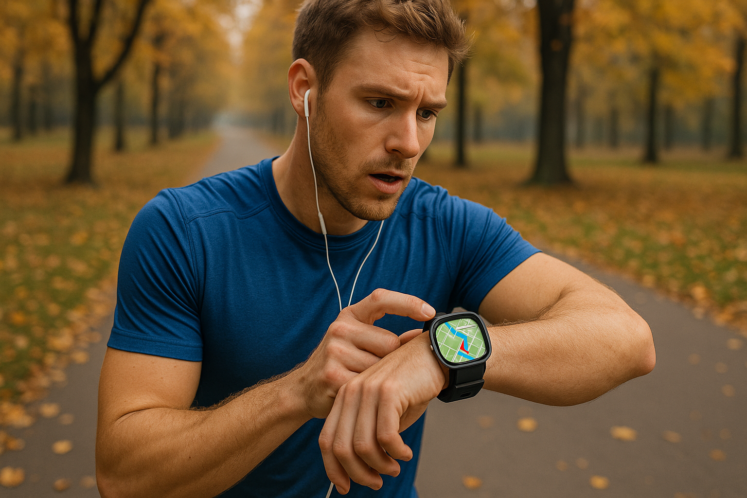
- Health and fitness: From step counters to running routes, GPS-enabled devices track your movements to help you stay active.
- Family safety: Parents use GPS to check in on kids, receive arrival alerts, or even create “safe zones” for elderly relatives.
One standout example of GPS-powered family safety is Number Tracker — a user-friendly app that helps families stay in sync.
For example, Apps like Number Tracker use GPS in conjunction with other technologies to let families stay connected, share real-time locations, and send quick alerts and share routes when needed or if something goes wrong — a practical use of GPS that goes far beyond directions.
From finding your lost phone to checking your child’s school route, GPS makes life more convenient and secure. And we’re just scratching the surface — because the GPS revolution is still evolving.
Mind-Blowing GPS Facts and Everyday Hacks
By now, it is clear that GPS is more than just a navigation tool. But even if you use it daily, there’s a good chance you don’t realize just how extraordinary it really is.
For starters, GPS satellites orbit Earth at an altitude of around 20,200 kilometers (12,550 miles) — and they’re moving fast, roughly 14,000 km/h (8,700 mph). That’s like circling the globe in under two hours.
These satellites run on ultra-precise atomic clocks, and — here’s where Einstein comes in — they have to account for the effects of relativity. Without these adjustments, your GPS would be off by nearly 10 kilometers (6 miles) every single day. And even though more than 30 satellites are active, your phone only needs to “talk” to four of them to figure out exactly where you are.
In short, every time you get directions or track your morning jog, you’re tapping into a system that blends orbital physics, time theory, and real-time data — all without thinking twice.
So yes, every time you check your phone’s location, you’re relying on orbital physics, advanced math, and Einstein himself. Now when you are impressed enough, let’s talk about practical hacks to use GPS smarter in daily life:
Simple GPS hacks for everyday life:
- Use “Only While Using the App” in your location settings to save battery
- Download offline maps when traveling to areas with poor signal
- Set up geofencing alerts in family tracking apps to know when a child leaves or arrives at a specific location
- Clear location history regularly if you value privacy
These little tweaks can make GPS work harder for you — and even improve your phone’s performance and battery life.
Where GPS Is Headed: A Look Into the Future
Like all great technologies, GPS isn’t standing still. Major upgrades are already underway, with next-generation satellites and smarter applications on the horizon. In the table below you can see what’s coming next:
| Innovation | What It Means for You |
| GPS III satellites | Improved accuracy, better anti-jamming protection |
| Galileo (EU) | Civilian-focused precision — great for emergencies |
| GLONASS (Russia) | Strong coverage at high latitudes (good for Arctic regions) |
| BeiDou (China) | A fast-growing global system with mobile integration |
| Augmented reality | GPS + AR = real-time overlays in navigation and gaming |
| Autonomous transport | Self-driving cars rely on hyper-accurate GPS + sensors |
As new systems emerge and work alongside traditional GPS, we’re moving toward a future of real-time, centimeter-level accuracy and are ready to open doors for smart cities, autonomous vehicles, precision farming, and more.
A Signal That Changed Everything
From high above Earth, GPS quietly powers the way we move, connect, and stay safe. What earlier began as a military innovation, now we are used to utilizing it as a global lifeline — adjusted to our daily routines and lifesaving tools. And with the development of the tech, so does its purpose. Perhaps that is the real genius behind it: GPS doesn’t just tell us where we are — it helps us move forward.